-
About Upazila
Introduce to Upazila
History-tradition
Geographical and economic
-
Upazila Parishad
Kamarkhand Upazila Parishad
Activities of Upazila Parishad
মাসিক সভার কার্যবিবরণী
স্থায়ী কমিটিসমূহের সভার কার্যবিবরণী
ADP
বার্ষিক উন্নয়ন কর্মসূচী(এডিপি) রিপোর্ট
বার্ষিক আর্থিক বিবরণী
পঞ্চবার্ষিকী পরিকল্পনা
-
Upazila administration
Upazilla Nirbahi Officer
Related to the organization
Important information
Services and others
-
Government office
Matters of law and order
Agriculture and food
Education matters
Land Related
Human resource development Related
Engineering and communication
-
E-services
National e-service
District e-Service
Get the necessary sites / blogs
Law Enforcement Agency
Science website
Edducation Related
Official addresses
National E-service
- Gallary
- Communication & Map
-
Others
Certificate related case
মেনু নির্বাচন করুন
-
About Upazila
Introduce to Upazila
History-tradition
Geographical and economic
-
Upazila Parishad
Kamarkhand Upazila Parishad
Activities of Upazila Parishad
মাসিক সভার কার্যবিবরণী
স্থায়ী কমিটিসমূহের সভার কার্যবিবরণী
ADP
বার্ষিক উন্নয়ন কর্মসূচী(এডিপি) রিপোর্ট
বার্ষিক আর্থিক বিবরণী
পঞ্চবার্ষিকী পরিকল্পনা
তথ্য প্রদানকারী কর্মকর্তা
সিটিজেন চার্টার
-
Upazila administration
Upazilla Nirbahi Officer
Related to the organization
Important information
Services and others
-
Government office
Matters of law and order
Agriculture and food
Education matters
Land Related
Human resource development Related
Engineering and communication
-
E-services
National e-service
District e-Service
Get the necessary sites / blogs
Law Enforcement Agency
Science website
Edducation Related
Official addresses
National E-service
-
Gallary
Fotogallary
ভিডিও গ্যালারি
-
Communication & Map
Educational Institutions
Online Adress
-
Others
Certificate related case
Main Comtent Skiped
Geographical Introduction
Geographical Introduction: -
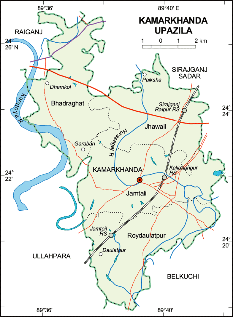
Kamarkhand Upazila (sirajganj district) area 91.61 sq km. Location: 24 ° 18 to 24 ° 26 north latitude and 89 ´ 358 to 89 ° 428 east longitude. It is bounded by Sirajganj Sadar and Raiganj upazilas on the north, Belkuchi upazila on the south, Belkuchi and Sirajganj Sadar upazilas on the east, and Ullapara upazila on the west.
Kamarkhand on the map

Site was last updated:
2025-05-29 22:07:39
Planning and Implementation: Cabinet Division, A2I, BCC, DoICT and BASIS


